Woodland Ridge Trail to Pollacappul Waterfall
A moderate 2-hour hike through native woodland with elevation gain. The trail ends at a scenic waterfall with views of the Twelve Bens mountains in the distance.
Getting to Know the Trail
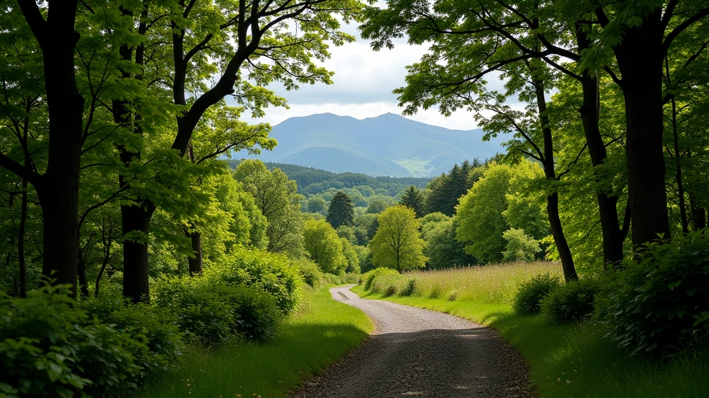
This trail isn't your typical park walk. You'll be climbing through actual woodland — the kind with roots, rocks, and real forest floor. It's the best route if you want genuine nature without the tourist crowds. The path follows an old forestry track for the first section, then narrows as it climbs toward the waterfall. You're looking at roughly 280 meters of elevation gain spread across two kilometers, which sounds more intense than it actually feels once you're moving.
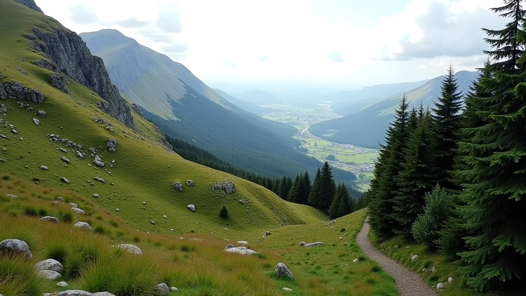
What makes this particular route special is the mix. You start in mixed conifer plantation, transition into native deciduous woodland, and finish at a proper waterfall with views that stretch toward the Twelve Bens. The whole experience takes about two hours at a steady pace, though many people spend longer at the waterfall just sitting and taking it in.
Key Information
- Distance: 4.2 km (round trip)
- Time: 2 hours at steady pace
- Elevation Gain: 280 meters
- Difficulty: Intermediate — consistent climb with some technical sections
- Terrain: Forest track, narrow woodland paths, rocky sections near waterfall
- Surface: Mixed — gravel, earth, root, stone
What You'll Actually Experience
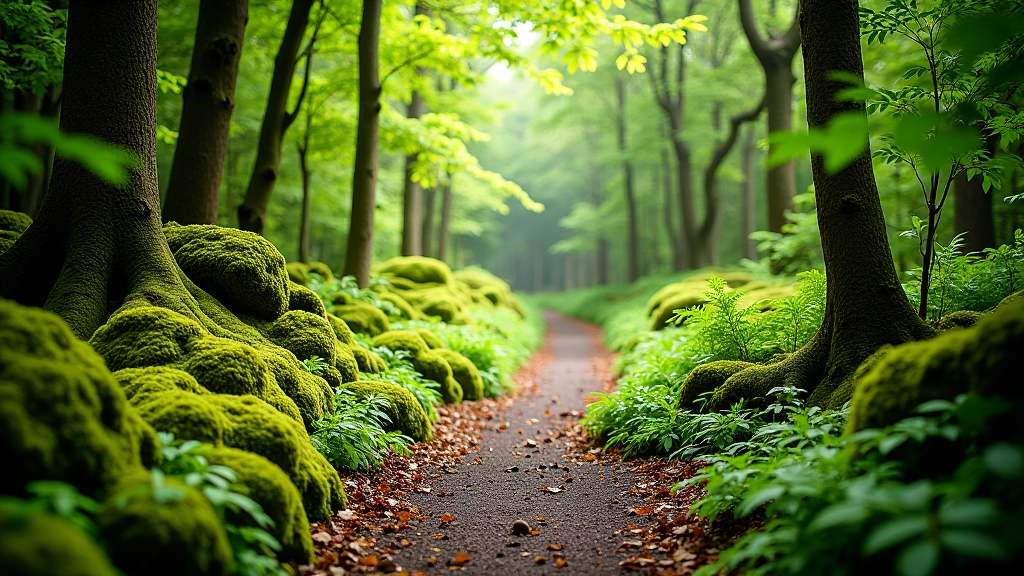
The first section is straightforward. You're on a well-maintained forestry track that climbs gradually through planted conifers. It's wide enough for two people to walk side by side, and there's no technical difficulty here — just steady uphill walking. Most people find this section easier than they expect, which is good because you're warming up your legs for what comes next.
Around the 1.5-kilometer mark, the track narrows and you transition into native deciduous woodland. The gradient increases. The path becomes narrower with roots crossing at ankle height and occasional loose stones. This is where it gets interesting. You're no longer on maintained infrastructure — you're on an actual mountain path. The views start opening up through the trees, and you'll see glimpses of the valley below. This section requires attention to your footing, but nothing that demands scrambling or technical climbing.
Reaching Pollacappul Waterfall
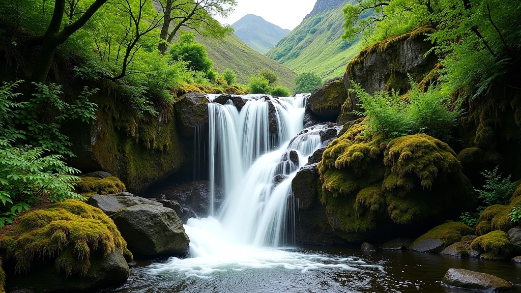
The final push takes about 20 minutes and gets steeper. You'll be using tree roots and rock features to pull yourself up. It's not dangerous, but it's definitely more challenging than the earlier sections. The path opens into a small rocky clearing where Pollacappul Waterfall drops down the cliff face. The water flow varies depending on recent rainfall — in summer, it might be just a trickle, but after heavy rain it becomes a proper cascade.
The best part? This spot doesn't get crowded. You'll find maybe two or three other people here even on busy weekends, unlike the main abbey area which draws hundreds. There's space to sit, have lunch, and actually absorb the place. The Twelve Bens are visible from here on clear days, and the views back toward the valley are genuinely spectacular. Most people spend 30 minutes to an hour at the waterfall before heading back down.
How to Prepare
What to Bring
You'll need proper footwear — not trainers, actual hiking boots or trail shoes with ankle support. The loose rocks and root sections will punish you if you're not wearing the right shoes. Bring water, at least 1.5 liters. There's a small stream along the path but it's not reliable, and you don't want to be thirsty near the waterfall with no way to refill. Pack some snacks or a light lunch because you'll want to sit and eat at the top. A lightweight waterproof layer is smart — the weather can turn quickly in the mountains, and you'll be exposed for the last section. Bring a phone for emergencies, but don't rely on it — signal is spotty in the woodland.
Start early. Most people do this hike in the morning or early afternoon. If you start after 2 PM, you're racing against daylight, especially in winter months. The path isn't lit, and it's not fun descending in the dark even with a headtorch.
Check weather beforehand. This isn't a technical climb, but wet rocks are slippery and the final section can be dangerous in heavy rain or wind. If it's been raining hard, the waterfall will be impressive but the path will be muddy and treacherous. Most locals will tell you that the best time is 24-48 hours after rain — the waterfall is flowing well but the ground has had time to drain slightly.
Practical Tips from People Who've Done This
Pace Yourself on the Climb
The second half is noticeably steeper. Don't burn out during the first section thinking it's all going to be easy. A steady, slower pace works better than trying to power through.
Watch Your Footing Near Roots
Twisted ankles happen here. The roots blend into the dark earth. Look down more than you'd normally hike — it's not scenic staring, it's injury prevention.
The Descent is Harder Than You Think
Your legs are tired on the way down. The downhill sections put stress on knees and ankles. Go slowly, use trekking poles if you have them, and don't let gravity pull you faster than your legs can handle.
Bring Insect Repellent in Summer
The woodland is lovely but midges love it too. A small bottle of repellent takes up no space and makes a huge difference in July and August.
Cell Service is Unreliable
Don't count on your phone for navigation or emergencies. Download a map beforehand. Tell someone where you're going and when you expect to be back.
Leave Plenty of Daylight
You want to be back at the car park before dusk. The path isn't dangerous in daylight, but darkness changes everything. Start early enough that you're comfortably finished by late afternoon.
Important Information
This guide is informational and educational. Hiking involves inherent risks including but not limited to falls, weather exposure, and wildlife encounters. You're responsible for assessing trail conditions, your own fitness level, and weather before hiking. Always carry a map, tell someone where you're going, and turn back if conditions become unsafe. This isn't an official trail with maintained infrastructure — it's a mountain path that changes with seasons and weather. The descriptions here reflect typical conditions but every visit is different. If you're not confident in your hiking abilities or the weather looks poor, it's completely fine to skip this hike or hire a local guide.